As the village grew, it was inevitable that some buildings will have been demolished and their sites redeveloped. Sometimes the later developments were given names that recalled what had been there before, such as Hawarden Cottage, which had formerly been called ‘Rushetts’, and stood where now is the top end of Burleigh Way at its junction with Hophurst Lane. It took its name from a village in what used to be Flintshire in North Wales. Crawley Down residents are apt to pronounce the Close which took its name as ‘har-warden’ but the Welsh village is spoken of as ‘harden’. Curiously, the house’s earlier name, ‘Rushetts’, had been the original name for ‘Red Court’, which lies off the east end of Sandy Lane.
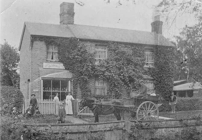
Pictures of a few of these lost buildings have survived. Opposite the war memorial there used to be Sunny Lodge, at the entrance to the drive to a larger house called Sunnyhill. Both are long gone but a postcard exists of the lodge with its elaborate barge-boards facing its gabled roof. On the opposite side of Sandy Lane two contemporary properties, Sunnyhill Farmhouse and Leigh Wood, sport similar barge-boards, which seem to have been a trademark style of a small number of houses built in the village in the 1870s, probably by the same developer, who may have been Richard Wilson Buckley who had inherited the Grange estate in 1862.
A short distance along Hophurst Lane from Sunny Lodge stood Fermandy Place, its name seemingly derived from a French surname. Originally known as ‘Eagle House’, or ‘The Eagles’, it later became ‘The Haven’. When it was sold after the Second World War, as Fermandy Place, its name was changed for the last time, to a preparatory school called Crawley St Mary’s, as some older residents of the village will recall.
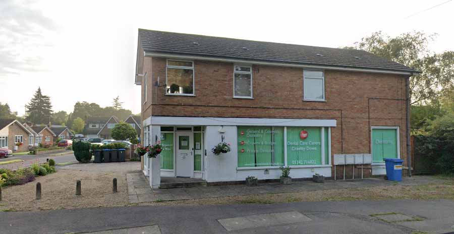
Along the Turners Hill Road, a little to the south of the Village Hall, lies Hazelwood Close on the corner of which is this building, formerly Manning’s the builders but for some time now where dental fittings are made. There was an earlier building on this site, which was a baker’s shop. Back in 1911, it was the home of Frederick Moon, baker and confectioner, and his family. Later it was run by the Holman family.
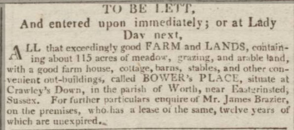
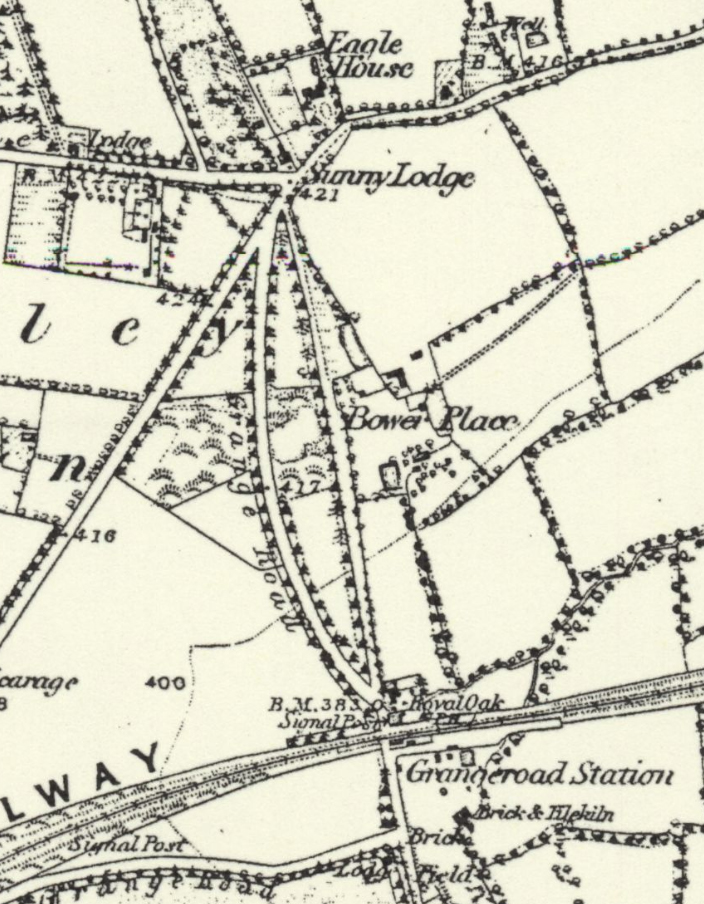
One building of which we have no picture is Bower Place Farm. Before 1890 when the terrace was built which has taken its name, there was a farm set back from the top of the hill. It probably dated back a long time for it occupied land which had been a freehold of the Manor of South Malling-Lindfield when a map was drawn of the manor in 1830, so it would have been considerably older than that. It had been advertised to let in 1813 and was still standing in 1874 when the 1st edition of the Ordnance Survey 6in map was published.
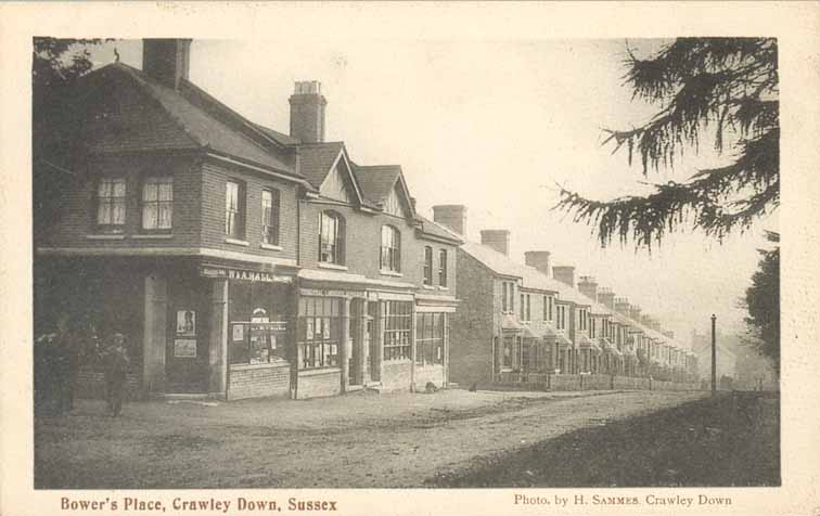
At the beginning of the 20th century Crawley Down was very much a village in two parts, each served by its own group of essential services. Along the Turners Hill Road were the church, the school, the village hall, the post office and a nursery, a general store (now an undertaker) and the baker’s mentioned above. On the other side of the village, north of the railway station, were some other shops at the top and bottom of Bowers Place, including a baker’s and a coal merchant, and a grocer’s at Elm House where the dentist’s is now.