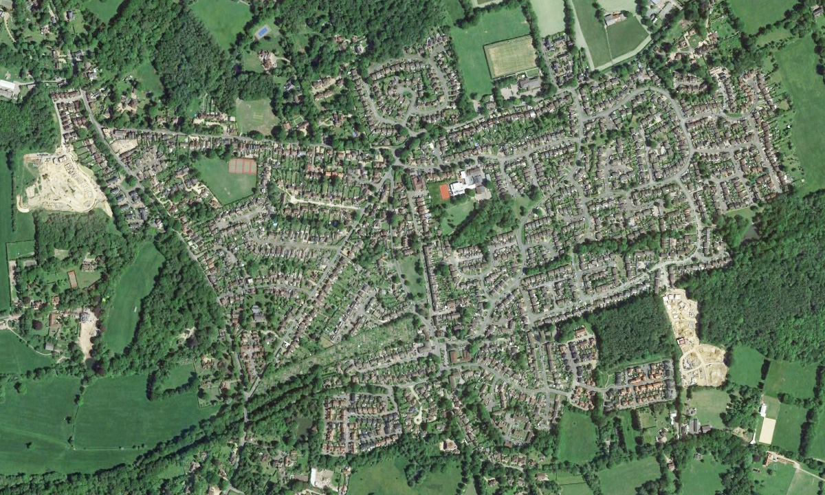
In the year of the Coronation of Queen Elizabeth II, and with the end of the Second World War just eight years in the past, Crawley Down, then in East Sussex, had changed little since the modest building boom that followed the break-up of the Grange Estate in the 1930s. Two triangles of roads made up the main outline of the village: Turners Hill Road and Sandy Lane, Grange Road and Bowers Place/Station Road, and Vicarage Road between them. Hophurst Lane led away to the north-east and Sandhill Lane/Burleigh Lane to the south. Only Sunny Avenue lay between either of those triangles, and of that only the western end had been built.
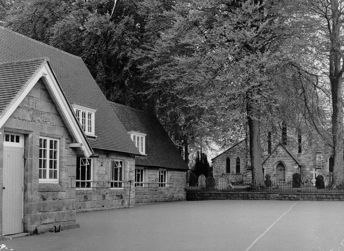
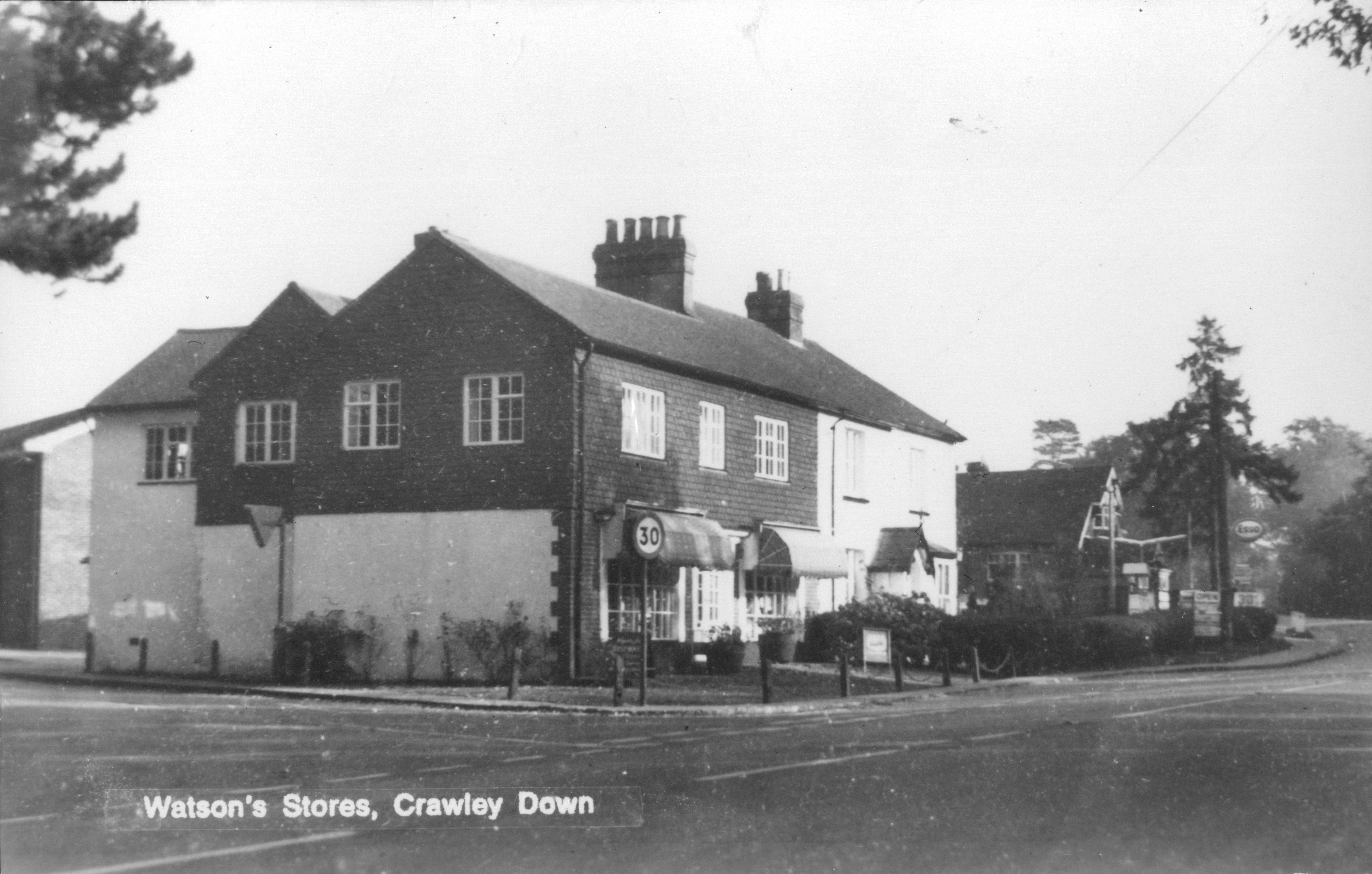
Village institutions still familiar to day were in place, though some were in different locations: All Saints’ Church with its Parish Room, the Village Hall and the Royal Oak. The Post Office was then on the Turners Hill Road, just round the corner from the end of Sandy Lane (see Crawley Down’s post offices), and the School was next to the church, also along the Turners Hill Road. There were the allotments and the Village Green, the Cricket Ground and King George’s Field, the last of these opened just before the war. There were shops, but not in the places where we have them now. Where the undertakers is now was Watson’s Stores and just along the road, between there and the Village Hall, was Hartley House petrol station. Halfway along Sandy Lane was a little shop, and there was a baker’s at the top of Bowers Place and a newsagent at the bottom. Away to the north, along the road from the Duke’s Head towards Felbridge was Snowhill Stores. Also in Sandy Lane there was a garage for car repairs, and the Methodist Chapel that had been built in 1895, but which was to close in 1965 and be successfully repurposed as an industrial unit.
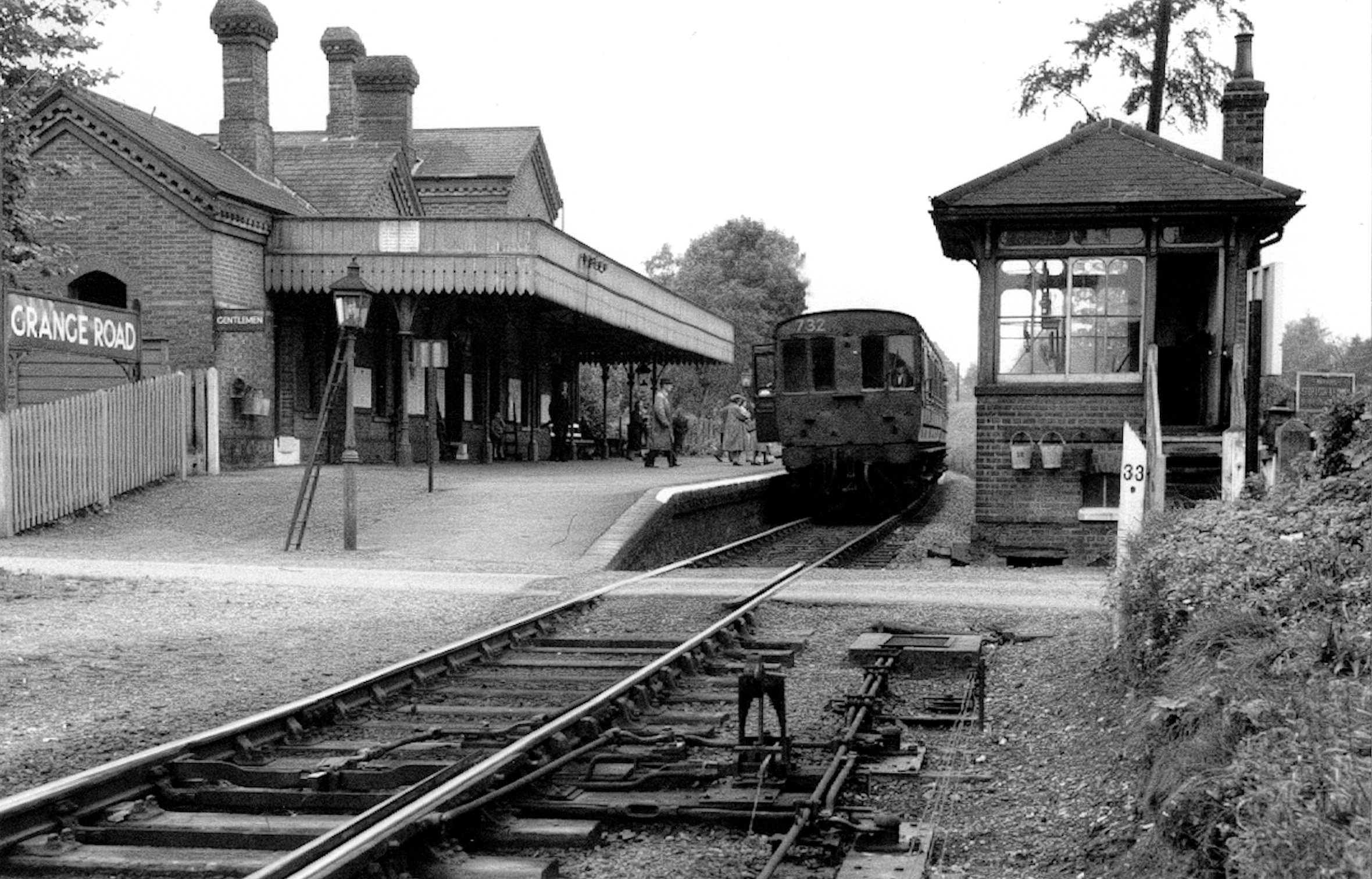
The most significant presence in the 1950s village was the railway with Grange Road station, a signal box and level crossing. The single-track line saw goods and passenger services between Three Bridges and Tunbridge Wells via East Grinstead. Where Auchinleck Court is now, there was a siding that used to serve the brickworks. Scrub land, once the site of other brickworks, lay behind Bowers Place.
The first post-war developments were Buckley Place, built by Cuckfield Rural District Council on what had been part of Vicarage Farm, and Ruffwood, a small, select group of houses in a close off the Turners Hill Road. That was followed by Grange Crescent and the completion of Sunny Avenue. The old brickworks site opposite the bottom of Grange Road became Kiln Road and Woodlands Close towards the end of the 1950s. This growing number of people living near the railway station, some of whom will have used the railway for a daily commute, prompted the need for three new shops – the present Co-op, Flanagan’s and The Pantry/hairdresser – that were built next to the signal box in the early 1960s. The rest of the old Vicarage Farm land was next, becoming Squires Close, and Hazelwood Close next to Ruffwood. And not long after, Beech Holme and Beech Gardens were built on land north of the allotments.
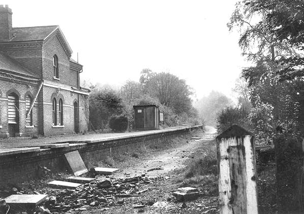
The closure of the railway line at the beginning of 1967 looked likely to stagnate Crawley Down. Ironically the line from Grange Road station to Three Bridges was still viable but Dr Beeching’s plans to close uneconomical lines looked at the whole route from Tunbridge Wells so the only part that was retained briefly was the stretch from the old wartime fuel depot at Rowfant to Three Bridges. Within a short time the track had been taken up and the Victorian station, that dated back to 1874, had been demolished.
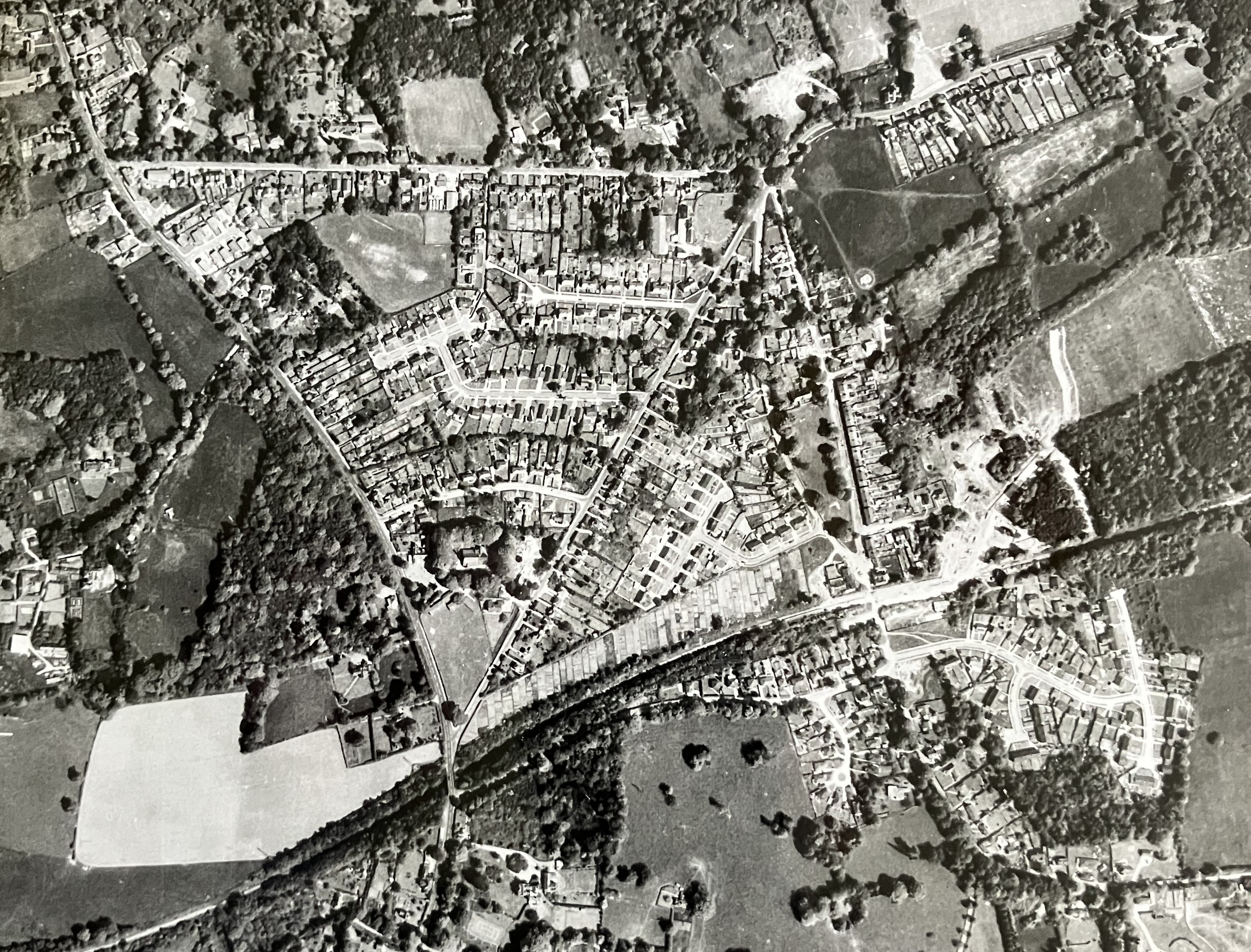
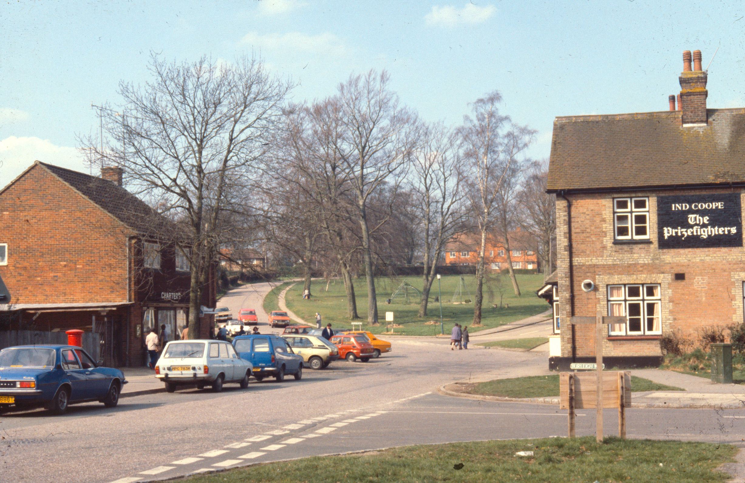
The sale of the old brickworks land east of Bowers Place and of the railway line to the south of it in the early 1970s led to the biggest change in Crawley Down since the village had begun to grow in the 1860s. The gradual construction of the Burleighwood Estate of over 800 houses over the next 10 years resulted in other changes as well: a new First School (Burleigh); a Health Centre , the previous surgery having been in a house in Hophurst Lane (see The History of Crawley Down Health Centre); more shops where the station had been; and the removal of the Post Office to what had become the centre of the village. Even the Royal Oak, which had started life as the Railway Hotel in 1866, was revamped and renamed The Prizefighters, ostensibly commemorating the sport of which Crawley Down had been a famous venue during the Regency period (see Prize Fighting), but which somewhat inappropriately displayed mementoes of the career of the 1940s boxer Freddie Mills.
In 1974, local authority reorganisation caused Cuckfield Rural District and, with it, Crawley Down to be transferred to the county of West Sussex and become the new Mid-Sussex District. Notwithstanding that, the expansion of the village led to three other small developments at the time, notably the Fermandy Place estate, on land cleared after the demolition of a large house that had been a private school, Crawley St Mary’s (see Lost Buildings of Crawley Down). Another was the land where the railway station had been, which became Old Station Close. The line itself to Three Bridges was designated a linear country park – Worth Way – so named after a competition in 1976 that was won by the Junior School’s pupils. Thirdly, the remainder of the old brickworks land behind Kiln Road was developed for social housing and appropriately named Bricklands.
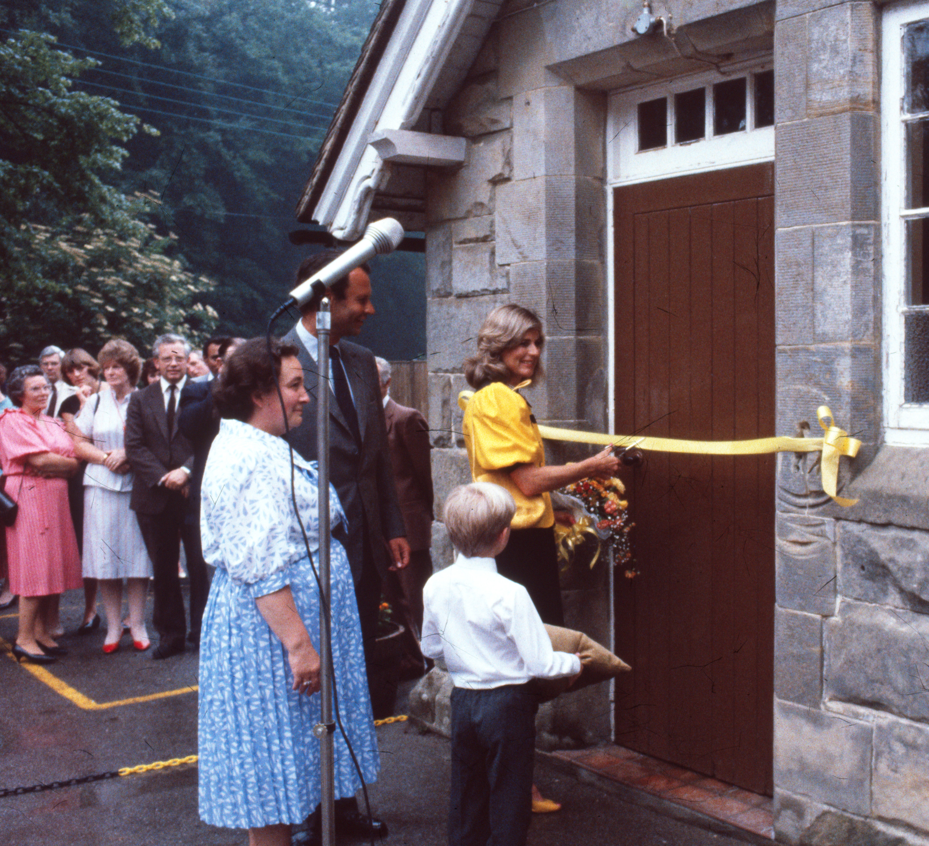
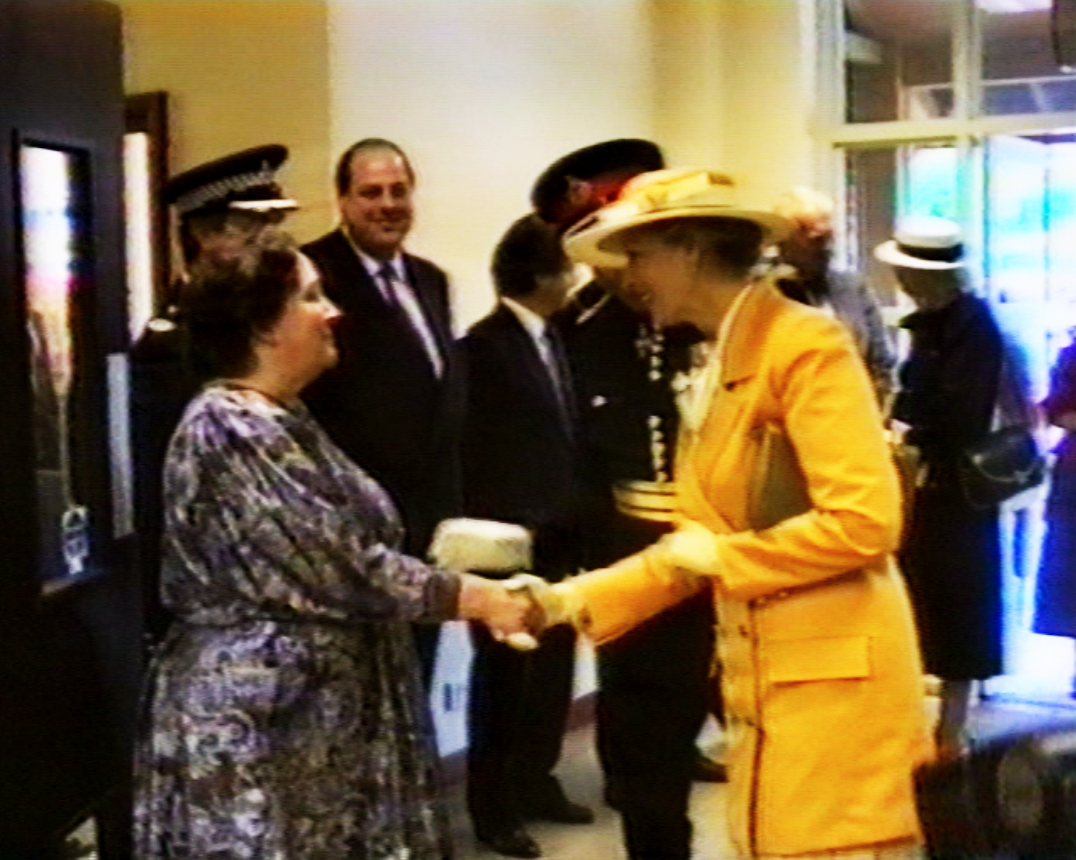
When the Junior School was rebuilt next to Burleigh School and opened in 1981 the old school buildings became redundant, though not before the Earl of Chichester, whose ancestor had given them to the village back in 1851, claimed his right under the original deed of foundation to have them returned to him. West Sussex County Council came to a financial arrangement with the Earl which, in time, enabled him to support efforts in the village to build a community centre. The considerably increased village population meant that the Village Hall, which dated back to 1890, was no longer able to cope on its own with the increased demands for amenity space. So in 1986 the old school became a proto-community centre while funds were raised for a purpose-designed centre to occupy a corner of the Haven Sports Field, which had been created out of the old Haven Farm in the 1970s to provided extra village open space. The Haven Centre opened its doors in 1990, and was officially opened by HRH Princess Alexandra in June 1991.
Crawley Down has continued to grow since then. New parish rooms have been built next to the church, the Junior and Infant Schools merged in 2006 and have been enlarged, the Health Centre, too, has been enlarged. On the down side the Royal Oak, in its revived form, now lies unoccupied. More houses have been built, on land in front of the Grange and on the north side of Hophurst Lane in 2012, on the west side of the Turners Hill Road from 2014 (and continuing) and, from about the same time, in the south-east of the village behind Woodlands Close and Hazel Way. If the fact that between 1921 and 1931 the population of Crawley Down had grown from 1,021 to 1,134, in 1953 it was probably not much more than about 1,200. In the census of 2021 Crawley Down’s population was 5,774.